


Voting District 417, Kay County, Oklahoma
About
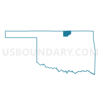
Outline

Summary
| Unique Area Identifier | 654210 |
| Name | Voting District 417 |
| County | Kay County |
| State | Oklahoma |
| Area (square miles) | 103.14 |
| Land Area (square miles) | 102.58 |
| Water Area (square miles) | 0.56 |
| % of Land Area | 99.45 |
| % of Water Area | 0.55 |
| Latitude of the Internal Point | 36.67809280 |
| Longtitude of the Internal Point | -97.37083600 |
Maps


Graphs
Select a template below for downloading or customizing gragh for Voting District 417, Kay County, Oklahoma


Neighbors
Neighoring Voting District (by Name) Neighboring Voting District on the Map
- Voting District 101, Kay County, OK
- Voting District 103, Noble County, OK
- Voting District 103, Kay County, OK
- Voting District 104, Noble County, OK
- Voting District 11, Grant County, OK
- Voting District 206, Kay County, OK
- Voting District 209, Garfield County, OK
- Voting District 26, Grant County, OK
- Voting District 405, Kay County, OK
- Voting District 420, Kay County, OK
Top 10 Neighboring County Subdivision (by Population) Neighboring County Subdivision on the Map
- Ponca City CCD, Kay County, OK (28,955)
- Blackwell CCD, Kay County, OK (8,080)
- Tonkawa CCD, Kay County, OK (3,978)
- North Garfield CCD, Garfield County, OK (3,398)
- East Noble CCD, Noble County, OK (3,084)
- Lamont CCD, Grant County, OK (860)
- Billings CCD, Noble County, OK (724)
Top 10 Neighboring Place (by Population) Neighboring Place on the Map
Top 10 Neighboring Unified School District (by Population) Neighboring Unified School District on the Map
- Blackwell Public Schools, OK (7,827)
- Tonkawa Public Schools, OK (3,929)
- Frontier Public Schools, OK (1,401)
- Deer Creek-Lamont Schools, OK (1,009)
- Billings Public Schools, OK (815)
Top 10 Neighboring State Legislative District Lower Chamber (by Population) Neighboring State Legislative District Lower Chamber on the Map
Top 10 Neighboring State Legislative District Upper Chamber (by Population) Neighboring State Legislative District Upper Chamber on the Map
Top 10 Neighboring 111th Congressional District (by Population) Neighboring 111th Congressional District on the Map
Top 10 Neighboring Census Tract (by Population) Neighboring Census Tract on the Map
- Census Tract 13.01, Kay County, OK (4,148)
- Census Tract 11, Kay County, OK (3,978)
- Census Tract 6, Kay County, OK (3,797)
- Census Tract 11, Garfield County, OK (3,398)
- Census Tract 9566, Noble County, OK (3,084)
- Census Tract 9565, Grant County, OK (3,052)
- Census Tract 9571, Noble County, OK (2,860)
Top 10 Neighboring 5-Digit ZIP Code Tabulation Area (by Population) Neighboring 5-Digit ZIP Code Tabulation Area on the Map
- 74601, OK (20,257)
- 74631, OK (7,709)
- 74653, OK (3,892)
- 74630, OK (702)
- 74643, OK (615)
- 74644, OK (478)
- 74636, OK (268)
- 74646, OK (233)